Non Precision Approach Page 8
VNAV Approach Procedure
We can let LNAV and VNAV do their own thing and all we have to do is just monitor progress and compliance.
You must have the appropriate Navigation aids selected and be monitoring the raw data (Nav aid indications on the ND, RMI etc)
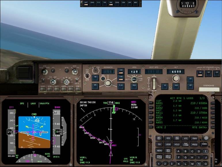
Turning onto the DME arc. Note that the MCP alt is down to 6500ft as a precaution but about to go down to 3200 ft which is the inbound altitude. As we are in VNAV PTH we could set 400 ft now. VNAV will ensure compliance with the arc restrictions which we programmed in (as long as VNAV PTH annunciated. This means the aircraft is on the programmed path. If it goes to VNAV SPD or VNAV ALT then you will need to do something).
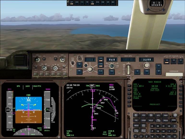 Here the aircraft is crossing the 315 radial. The easiest way to check this is to select the NAVRAD page. Put NR in as the VOR and you will get a radial readout under RADIAL. You could also press the button marked CTR on the EFIS control panel and look at the green VOR needle tail to determine the VOR radial you are crossing. Note we are passing 5600 ft and are well above the required 3700 ft. I have also set the inbound course on the left VOR (185). All this does is select the radial I want to monitor if I choose to use the traditional VOR presentation (select VOR on EFIS control panel instead of MAP).
As we approach the turn onto final we should be in VNAV and the FMA (flight mode annunciator on the pilots PFD (primary flight display)) should indicate VNAV PTH or VNAV ALT. If we haven’t done so already we should open the speed window on the MCP (mode control panel on glareshield) and control the speed directly.
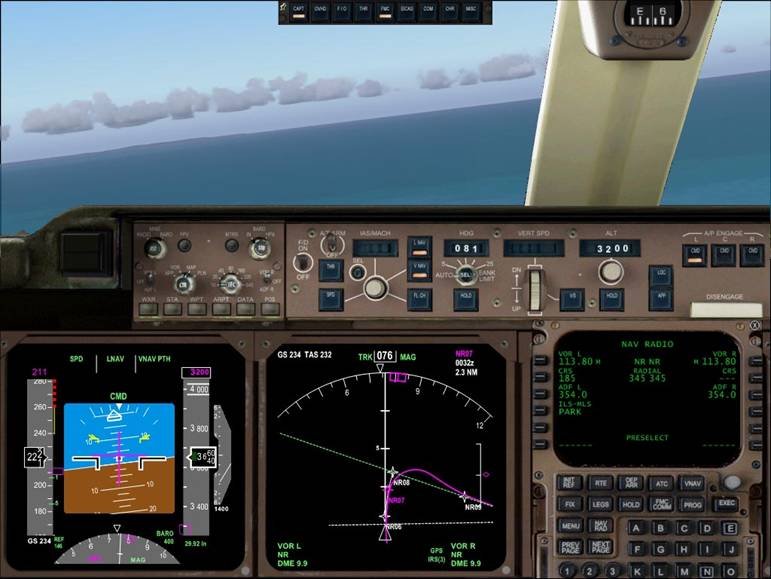
Crossing the next alt restriction, the NR345 radial not below 3300 ft. Don’t worry about the magenta line looking like it is out of whack. It will sort itself out closer to the next waypoint. Keep updating your heading bug just in case you need to revert to it (you don’t want to select HDG SEL and find that the aircraft does a wild turn in some odd direction catching you unawares. Notice we are still in VNAV PTH and the vertical track indicator (glideslope type display on the RH side of the ND (Nav display)) looks good. I would now think about selecting 400 feet in the MCP alt window.
If the indication is VNAV SPD then you are not on the path. Have a look at the vertical track indicator (on the ND) and adjust your descent profile so as to intercept the path. If you are in VNAV ALT you will have to reselect an altitude on the MCP and push the altitude button when approaching the desired descent profile in order to descend. It is also a good idea to have PROG page 2 selected as this will give you very accurate information as to your displacement from the calculated VNAV PATH when descending on the final approach course. If you are indicating VNAV PTH or VNAV ALT then select the MCP alt down to the nearest 100 ft below MDA (if not an even 100ft increment ie. An MDA of 430 ft would be set as 400 ft on the MCP. As we have an MDA exactly equal to 400 ft for this approach we can set 400 ft.
When we are more than 300 ft below the Missed approach altitude we reset the MCP altitude up to the Missed approach altitude. This should stop VNAV trying to level off at the Missed approach altitude instead of continuing down our slope towards MDA. The missed approach altitude for this approach is 3000 ft so after we pass thru 2700 ft we will reselect it from 400 ft to 3000ft. This procedure works well in the RW aircraft but sometimes the VNAV in the PMDG aircraft will try to depart the path and go for the new missed approach altitude you have just set. If it does this then reset it back to MDA and try again later. By now you should be flying down the slope with LNAV Taking care of the tracking and VNAV taking care of the vertical profile.
All we do now is check the distance to go against the required altitude published at the base of the approach chart.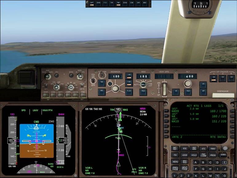
Here we are at the 7 nm point and the charted altitude is 2300 ft. The MCP ALT is down to 400 ft and we are on speed. Notice the VOR raw data is displayed via the green needle on the ND and confirms the inbound course. As we are more than 300 ft below the Missed Approach altitude we can set the MCP ALT to 3000 ft. If it goes out of VNAV PTH when you are setting the altitude then select VERT SPD and then back to VNAV again and ensure VNAV PTH annunciates.
Remember to reconfigure the aircraft. If the weather is poor then do this earlier rather than later so you do not have to be distracted with reconfiguring the aircraft when instead you should be monitoring the instruments and looking for visual clues. Progressively bring the speed back via the speed knob as you put out flap and gear. In IMC (Instrument meteorological conditions…...That’s cloud or low visibility in normal speak) then you should be in the landing configuration and be on speed (within +10/-5 of your TTS).
NOTE:
If you are flying a medium to heavy jet then you will need to add 50 ft to the MDA altitude unless a DA (decision altitude) is published on the chart. This is because due to aircraft inertia it will descend a further 50 ft during the Go-around maneuver. In order not to descend below 400 ft MDA (minimum descent altitude) we would need to commence our GA at 450ft.
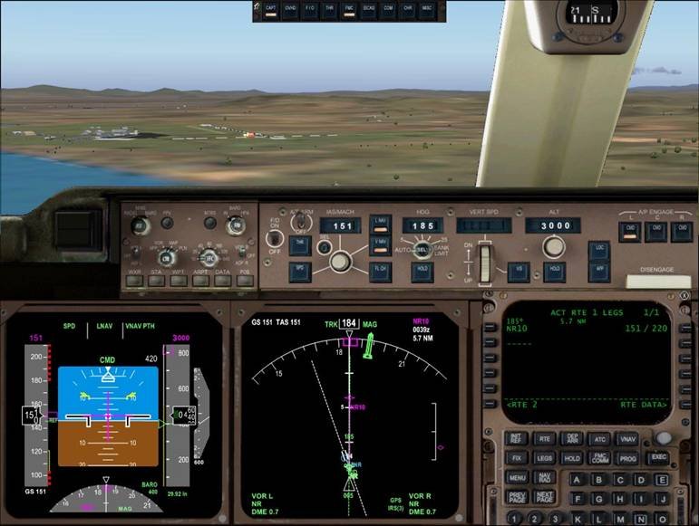
Minimum Descent Altitude. Notice how the active waypoint has changed to the last one already. If we did not have this in there then the FMC would come up with “NO ACTIVE ROUTE” and default to HDG HOLD and ALT HOLD. With that point in at 5 nm past the MDA point it remains in LNAV and VNAV PTH. From this point we are in good shape. Disconnect the autopilot and autothrottles and land.
Be prepared to revert back to manual modes (HDG SEL and VERT SPD) should LNAV or VNAV not do what is expected.
Always have the appropriate navigation aids tuned and cross check the FMC track with the raw data track.
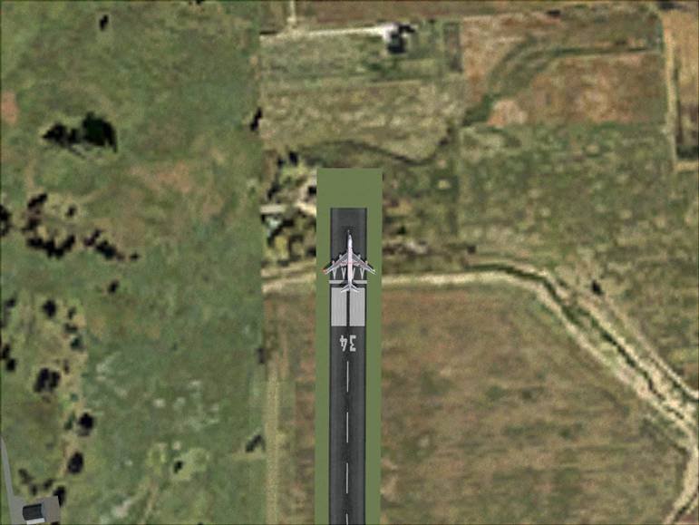
Phew, it just fits!
I hope that this guide gives you some insight into the Non ILS approach procedures and how to go about planning and implementing them.
The general rules of thumb can be used in many aspects of aviation and can therefore be applied as you see fit.
If you have spotted any areas that are incorrect or you require clarification of any of he above points then please contact me:
Steve Hall
cowpatz93@hotmail.com
<< Prev Page - Start Over >>

